Geographic mapping of inaccessible locations

Our drones provide detailed geographic maps of hard-to-reach areas, offering precise data and insights for your projects.

Explore Services

Aerial photography for journalism and film

Capture dynamic and engaging aerial footage for news stories and film productions, offering a fresh perspective that elevates your narrative and visual storytelling.

Explore Services

About us

SkyHigh Drones

SkyHigh Drones is a leading provider of innovative aerial solutions, established in 1999. Our team of certified professionals combines cutting-edge technology with extensive experience to deliver exceptional drone services. We specialize in aerial photography, mapping, and inspections, ensuring top-quality results for every project. Driven by a passion for excellence and customer satisfaction, we tailor our services to meet your unique needs and elevate your vision from above.

...
24

Year's experience

Our services

Custom Drone Solutions
Tailored Aerial Services for Unique Needs

At SkyHigh Drones, we understand that every project is unique. Our Custom Solutions offer tailored drone services designed to meet your specific requirements. Whether it's a specialized aerial survey, a unique data collection project, or a bespoke filming request, our team will work closely with you to craft a solution that fits your needs perfectly. Contact us to discuss your project and let us create a customized plan to achieve your goals.

Aerial Photography & Videography

Explore the sky with our top-notch aerial photography and videography services. Whether you're capturing breathtaking landscapes or detailed architectural shots, our advanced drones deliver stunning, high-resolution imagery. With expert pilots and cutting-edge technology, we provide clear, dynamic visuals that elevate your projects.

Our services are designed to meet a variety of needs, from real estate and construction to events and inspections. We offer comprehensive solutions, including precise planning, professional editing, and timely delivery of your content. Trust us to provide exceptional aerial perspectives that will impress and engage your audience.

Key Benefits:

Elevate your visual content with our professional aerial services and see the world from a new perspective.

Mapping & Surveying

Our mapping and surveying services provide precise and detailed data essential for successful project planning and execution. Utilizing advanced drone technology, we deliver high-resolution aerial imagery and accurate topographic maps. This enables efficient monitoring and analysis of land and infrastructure, ensuring that your projects are executed with the utmost accuracy.

We handle every aspect of the surveying process, from initial data collection to detailed analysis, offering insights that drive informed decision-making. Our team’s expertise in handling complex surveying tasks guarantees reliable results tailored to your specific needs.

Whether you’re involved in construction, real estate, or land development, our comprehensive mapping and surveying solutions offer the clarity and precision necessary for optimal project outcomes. Trust us to provide the data you need to move forward with confidence.

Inspection Services

At DroneWorks, we offer comprehensive inspection services that ensure thorough and precise evaluations. Our cutting-edge drone technology allows us to capture high-resolution images and detailed data, providing a clear view of your assets and operations. Our inspections are designed to identify potential issues early, enhance safety, and streamline maintenance processes.

We specialize in various types of inspections, including industrial equipment, infrastructure, and environmental assessments. Our team uses advanced imaging and analytical tools to deliver accurate and actionable insights, helping you make informed decisions and maintain operational efficiency.

By leveraging our drone-based inspection services, you benefit from reduced downtime, improved safety, and a more efficient inspection process. Trust DroneWorks to deliver reliable results and support your ongoing maintenance and safety needs.

Agricultural Monitoring

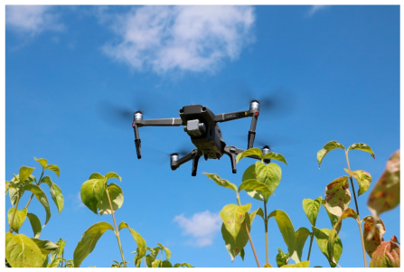
Modern agricultural monitoring has been revolutionized by advanced technologies like drones and remote sensors. These tools provide high-resolution imagery and real-time data, offering farmers an unprecedented view of their fields. By using drones for aerial surveys, farmers can accurately assess crop health, soil conditions, and overall field performance, identifying issues such as pest infestations and nutrient deficiencies before they become critical problems.

Integrating this technology into farm management systems allows for more precise decision-making and resource management. Data-driven insights help optimize irrigation, fertilization, and overall field management, leading to healthier crops and increased yields. As agriculture continues to evolve, embracing these innovations is crucial for improving productivity and sustainability in farming practices.

Emergency Response & Surveillance

In critical situations, timely and accurate information can be a matter of life and death. Drones have become invaluable tools in emergency response and surveillance, providing real-time data and comprehensive aerial views that are crucial for decision-making. Whether it's natural disasters, search and rescue operations, or security monitoring, drones enhance situational awareness and improve the efficiency of response teams.

By deploying drones, emergency responders can quickly assess damage, identify safe routes, and locate individuals in need of assistance without putting personnel at risk. In surveillance, drones offer a discreet and cost-effective way to monitor large areas, detect unusual activity, and ensure public safety. The versatility and rapid deployment capabilities of drones make them essential assets in modern emergency response strategies, helping to save lives and protect communities.

Notable projects

Revolutionizing Urban Planning with Aerial Precision

Our drone services have transformed urban planning by providing detailed aerial surveys and 3D mapping for major development projects. With our high-resolution imagery and precise data collection, we've helped clients visualize and plan complex projects more effectively, resulting in smoother execution and optimized outcomes.

Remote Pipeline Inspection

Ensure the integrity and safety of your pipelines with our advanced remote inspection services. Utilizing high-resolution drone technology, we provide detailed aerial inspections that detect issues such as leaks, corrosion, and structural damage without the need for invasive methods. Our drones capture real-time footage and high-definition images, allowing for comprehensive analysis and timely maintenance decisions, ultimately saving you time and reducing operational risks.

Our remote inspection solutions are designed to handle pipelines in challenging and hazardous environments, including those in remote or hard-to-access locations. By leveraging our cutting-edge technology and expert analysis, you can achieve a thorough inspection while minimizing downtime and enhancing overall safety. Our team is committed to delivering precise and actionable insights to ensure your pipeline systems operate efficiently and remain in optimal condition.

WRC Rally Finland Drone Coverage

Experience the thrill of WRC Rally Finland from a new perspective with our cutting-edge drone coverage. Our drones capture every high-speed moment and scenic view, offering dynamic footage that showcases the exhilarating twists and turns of this iconic rally. From breathtaking aerial shots of the rugged Finnish landscape to close-up action of the rally cars in full flight, our coverage delivers an immersive and engaging viewing experience for fans and enthusiasts alike.

Our team of experienced drone pilots ensures that every critical moment of the rally is captured with precision. By leveraging advanced drone technology, we provide unparalleled views that traditional camera setups can’t match. Whether you’re looking to relive the excitement of the race or analyze the performance of your favorite drivers, our detailed and high-quality footage offers a comprehensive look at one of the most challenging and exhilarating events in motorsport.

SAR Operation In California

In a recent search and rescue (SAR) operation in California, our drones played a critical role in locating a missing hiker in a remote area. The rugged terrain and dense forest made traditional search efforts challenging, but our drones equipped with thermal imaging cameras provided aerial surveillance that quickly identified the heat signature of the missing individual. This advanced technology not only expedited the rescue but also ensured the safety of the search teams by navigating through difficult terrain from above. The operation highlighted the effectiveness of drones in emergency response, demonstrating their ability to cover large areas quickly and provide real-time data to rescue teams on the ground.


Frequently asked questions

...

...

...

...

...

Recent news & articles

Quote sign

“Linus Torvalds is the creator of Linux and a key figure in the open-source community, driving innovation and development in technology.”

Linus Torvalds
Linus Torvalds

Fellow, Linux Foundation

Quote sign

“Steve Jobs was a visionary leader who co-founded Apple Inc. and revolutionized the technology industry with innovative products like the iPhone and MacBook.”

Steve Jobs
Steve Jobs

CEO, Apple Inc.

Quote sign

“Elon Musk is the visionary founder and CEO of SpaceX, leading the charge in advancing space exploration and technology.”

Elon Musk
Elon Musk

CEO, SpaceX

Get in touch

Want to get in touch? We'd love to hear from you.